Norway day 16: Ex Norway!

So, with a slightly heavy heart, (as I’m glad to be starting the homeward stretch of this journey) I bid farewell to Norway. It is a spectacular country and if it is to really be experienced it needs to be by road, traveling to, and staying in a different place each day.

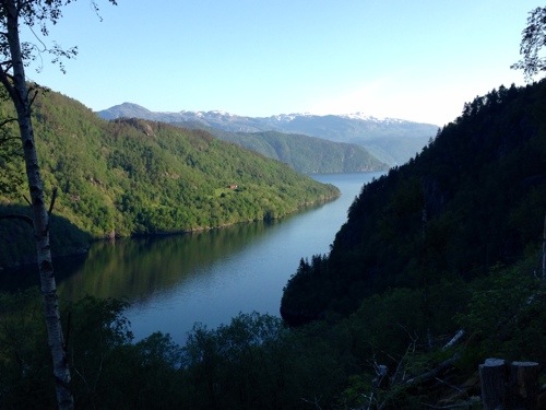
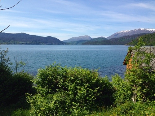
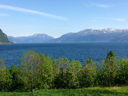
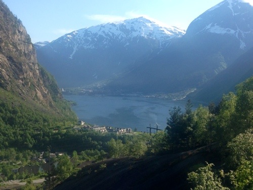
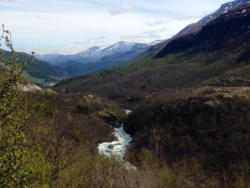
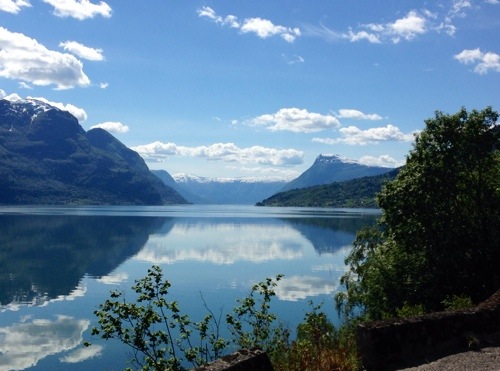
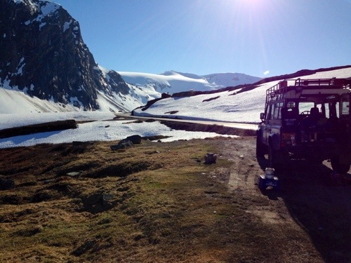
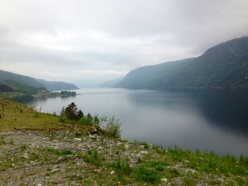
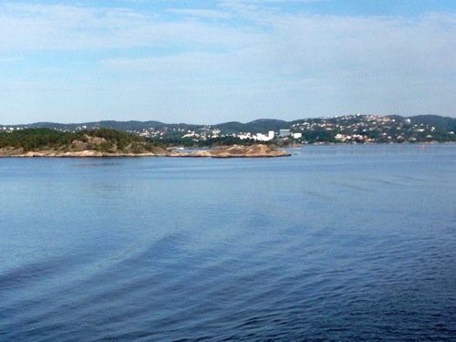
My final view of Norway…..

20140531-173556-63356761.jpg

I fully understand why there are so many Motorhomes on the roads there, it has to be the best way to see the country.

In recent years however, due to the increase in Motorhome usage, especially foreign visitors, there has been a ban on camping on the open road. There are a great many rest stops however that seem to be widely used by Motorhomes, and I would say so long as you’re considerate and leave no rubbish around, this seems fine.

Fortunately one of the benefits of travelling in the Landy is the ability to pretty much park up on any space I found. I ensured that I wasn’t damaging the flora and fauna, and took all of my rubbish away with me.

I would also imagine, that as the summer fully gets underway in Norway, the roads will become crammed full of Motorhomes and therefore finding places to stay will become really difficult, let alone trying to get around the mountain roads with convoys of them oncoming At you. To get two past each other at times is one hell of a squeeze and I wouldn’t fancy trying it.

I would say that this must be the best time of year to visit Norway; yes there is a risk that some routes may not yet be open after the winter, but, to have the mixture of snow, powerful waterfalls and rivers, and the lush green all in the same period of time is fantastic.

I’m confident that whilst I’ve spent time in some of the most fabulous of places, I also haven’t damaged any of the environments that I occupied (well except for the engine fumes). I think it’s important to remember that whilst I have the ability of the 4×4, there is the responsibility to use it wisely and not churn up and destroy the good ground you occupy.

Others should be given the opportunity to be amazed by their surroundings, just as much as I have.

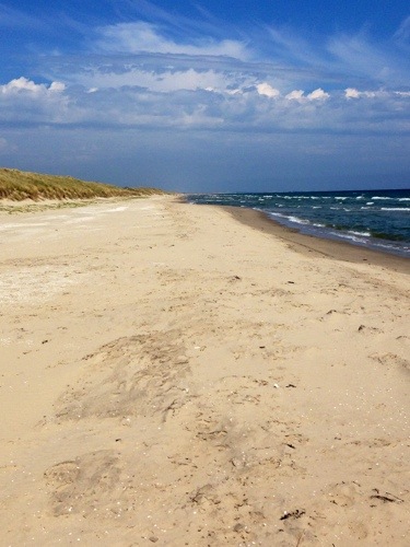
Upon disembarking the ferry at Hirtshals, I started to think about what to do with some of this additional time I found myself with. After having a quick browse on the internet, my first port of call would be Skagen, the most northerly point in Denmark.

And fabulous it is too! Miles of sandy beach, and again being a nice warm day it was ideal for a walk along. So ideal in fact that I lost track of time!

After now having lunch, I think I’ll stay here for the night as the car park allows camping.

I may go for another stroll later.
20140531-173715-63435469.jpg

Norway Day 15: Heading Out

I woke up today feeling satisfied and content.

I’d spent an hour or so last night poring over the maps again, looking to see if there was anything else I wanted to do before moving on as I found myself again with a good day,or more, spare.

But no, I was pleased that I’d travelled everywhere I wanted to, I’d seen everything that I wanted to, and achieved all that I planned to. I felt very at ease and complete with the time I’d spent here.

So, I started to make way on my final route in Norway.

I was heading for Kristiansand from where I’ll be taking a ferry across to Hirtshals in Denmark.

The route was a scenic one (of course), predominantly along the South Western Coast of Norway alongside the North Sea. The land around there was relatively flat and agricultural, the sea was just a little bit boisterous, with a blustery wind pushing it along.

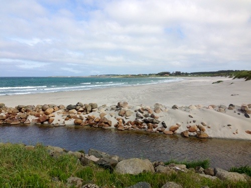
I took the opportunity to have breakfast just by a beautiful white sand beach. With the blowing wind picking the fine sand up and throwing it at me however, the breakfast actually took place about a hundred yards away out of the wind.

20140530-170612-61572398.jpg

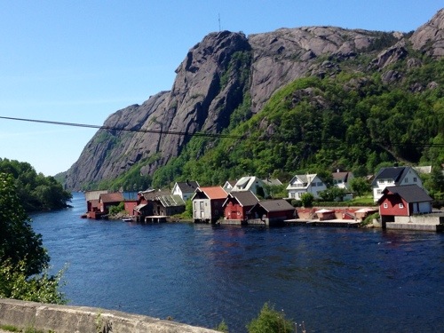
Shortly, I was back into mountains again, surrounding the fjords, this time the fjords seemed small, somewhat narrower than others. This it seemed encouraged the local folk to place their houses a little closer to the water than usual.

20140530-171230-61950334.jpg

There wasn’t much opportunity for photos along this route, the twisty turny roads didn’t let up for long enough to stop.

I think I’m going to miss being surprised by something around each corner of the twisting winding lanes up and down the mountains, although, I’m not actually going to miss the lanes, not for a while. It’s been a hard slog on occasions coaxing the Landy up and around them, whilst also avoiding motorhomes and lorries coming in the other direction.

I’m parked up near Kristiansand, on a not particularly appealing bit of industrial dirt. Still surrounded by trees and a stream, but this close to a town, pleasant parking or rest areas become scarce.

The ferry sets sail at 8am leaving the fjords and mountains behind. By midday, I’ll be well into Denmark.

Norway Day 14: Time for Prayer.

I was woken early today by the thundering of the waterfall nearby. I’d been joined in the night by two motorhomes, and conscious that I didn’t want to wake their occupants with the din of making breakfast, I got myself ready and set straight off.

It was about 6am and I was traveling South along ’13’ from Røldal towards Oanes and there was not another soul on the road.

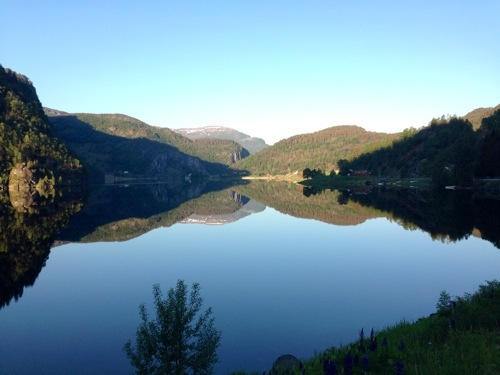
This was easy cruising, the morning sun was still quite low, and was casting perfect reflections on lake Sudalsvatnet.

20140529-180533-65133462.jpg

The road continued alongside Jøsenfjord, a narrower fjord than others, surrounded with lush green trees.

20140529-181433-65673345.jpg

I trundled on, and after a short ferry crossing from Nesvik to Hjelmeland I made headway for the last major attraction on my tour of Norway; Preikestolen, ‘The Pulpit Rock’,

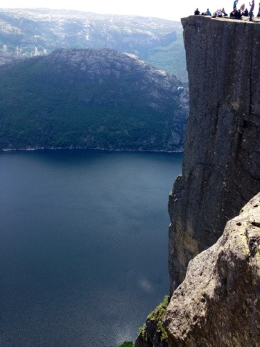
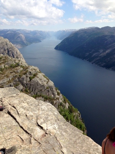
Preikestolen is a cliff which rises 1969ft out of Lyseford. It’s a 2 hour ‘walk’, to get to it from the car park, and damn! You know you’ve walked. Walking is quite a loose term for how you get to it. Yes there’s some walking, but it’s mostly making your way up and down steep inclines of rocks that are roughly set out to be used a steps, then scrambles down other rocks etc etc.

But it’s worth it!

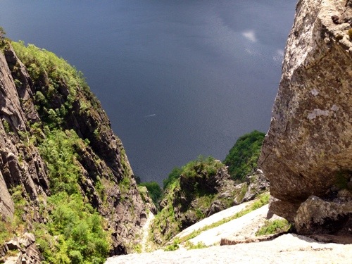
20140529-183614-66974419.jpg

You can just about see a boat in the above image!

20140529-182824-66504909.jpg

20140529-182826-66506322.jpg

Stunning!

This must have been the most inaccessible place in Norway I’ve had to get to, but it’s the busiest place I’ve been! Hundreds of people queuing their way up and down the trail, on the way down, not inly did I have to take care not to slip or fall myself, but that I didn’t cause a domino run by knocking anyone over coming the other way!

It was a short road day, but a great day. Straight after leaving Priekestolen I pulled into the first picnic area I found beside Lysefjord. It’s also occupied by a DHL lorry that seems pretty well set for the night.

Well if it’s good enough for him……

Norway Day 13: a relief !

I was due to arrive in Bergen by the end of today, it was only 30 minutes away but I made a choice to get back into the country.

After making use of the campsite amenities, refilling water canisters, and giving the Landy a once over and topping up the transfer box oil, I moved on.

last night, I’d been poring over the map to get a route out of here that wasn’t a trunk road and, found road ‘7’.

I left the campsite late in the morning. The sun was shining early and as hot as it had been for the past few days.

Bliss!

Within a handful of miles I was on ‘7’, a route to Hardanger that I wasn’t originally going to take but so glad that I did. I was back onto quieter roads, amongst the mountains, fjords and rushing rivers that are always so extraordinary and even more so in the brilliant sunshine.

Here, driving alongside Bjørnefjorden, everything was back in order, all was right again.

20140528-202223-73343015.jpg

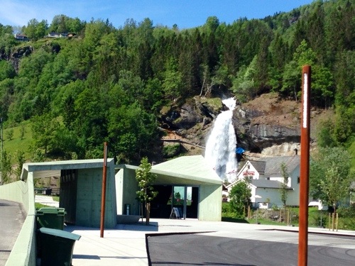
‘7’, brings me to start the Hardanger Nasjonale Turistveger at Steinsdalsfossen, one of the architectural attractions.

20140528-202424-73464624.jpg

This route is actually two routes, one that takes you across from East to West along the north of Hardangerfjord and off into the country, and a route that starts further South, heads North and follows a upside down ‘V’ back South again. I’m opting for a little of both. East to West for a while and then south from the ‘point’ of the ‘V’ down it’s right side which is past Sørfjord

Hardangerfjord seems to have a bit more attitude about it’s presence than the others seen so far. Unlike the almost mirror flat surfaces of the others, Hardangerfjord has some moves! Well, may be two or three inch high ripples!

20140528-202623-73583255.jpg

To head South requires a double ferry jump, from Kvanndal to Utne, and then Utne to Kinsvarnik.

Sørfjord, is as beautiful a fjord as the rest, it seems that there is no such thing as a ‘bad’ fjord, and you can’t go wrong with visiting any of them.

20140528-202829-73709153.jpg

The route ends near Odda but gives a little surprise at the end by giving us this!

20140528-204807-74887611.jpg

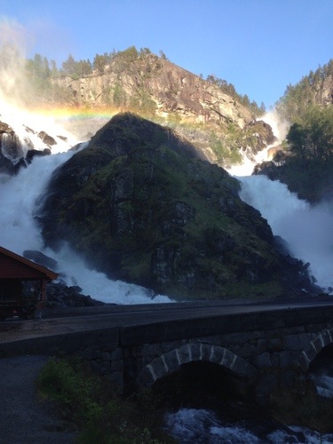
Two waterfalls that are so powerful they’re spreading their mist across the road! A great finish.

So where am I tonight?

Somewhere near Røldal. Near a Ski Centre that I doubt if getting much use right now.

20140528-203811-74291677.jpg

Much better than a campsite..!

Norway Day 12 [supplemental]: It’s not the same….

The language is the same. The road signs, they look the same. The fuel stations and the shops, they also look the same. I’m fairly sure it’s the same Sun.

I can’t quite put my finger on why, but it’s not the same.

From the point that I joined the E16 at Aurland, I had a nagging sense that something was different.

Maybe it was the road that now had a purpose; it had to get somewhere, it didn’t meander, or wander around gazing in wonderment at all that there was to see.

Maybe it was the proliferation of ‘safety’ cameras; I’m sure my speedometer is inaccurate by just enough that by counting the red flashes I was captured by five!

Maybe it was the seemingly infinite number of tunnels I had to pass through, one of which is a marvel at 24km long!

Maybe it was the lack of places to pull over at the side of the road and take a look at all there was around and, try to capture ‘the shot’ which nobody has seen before, that would get on the cover of National Geographic Magazine.

Maybe it was that after an hour of searching back roads to try to find a great place to park up of the night, I find myself in one of those hideous places; a campsite!

One thing I’m sure of, things seem less natural, less environmental, less colourful.

There are more grey buildings, there are more cars on the road and, they’re in a rush to get somewhere. Even at 11:30pm, I can hear the vehicles on a busy main road close by. I could be in any town or city now.

Here, 25 minutes outside of Bergen, whilst I can still see a mountain only a few fields away, I don’t feel close to this magnificent country anymore.

Norway Day 12: Two outta three ain’t bad!

Today was definitely due to be a 3 Najonale Turistveger day, one long route, and two short routes, easy,

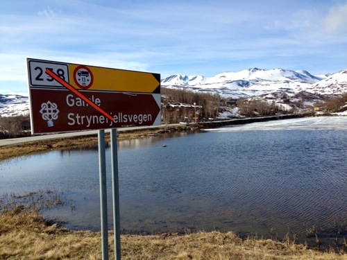
I set off in search of the first, Gamle Strynefjellsvegen. It’s start was only about 24 miles from when I ended yesterday, a quick 30 minutes drive to get on it. But as I got to the first sign, it was a no go, clearly marked as closed, probably as the road hadn’t been cleared yet after the winter.

20140527-195408-71648780.jpg

So off to the next one, this wasn’t so bad either as I would have needed to turnaround at the end of the first one and do it again to get the start of the second.

This was another hour or so down the road, so off I went.

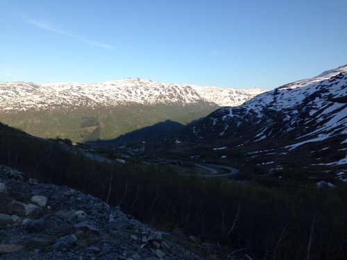
Route sognefjellet took me over Sognefjell, a mountain in the Jotunheimen mountain range, a more barren and rocky landscape than I had seen in other places. A rugged area, less plush than Geiranger, but still spectacular.

20140527-195410-71650198.jpg

Up here, lakes still had the last broken remnants of being frozen floating on the top, the air is fresh, and again the sun shining brilliantly.

I was driving past waterfalls (of which there are many!), and through channels in the snow that had been cleared for the road to be accessible, some of these were so deep that the snow was several feet higher than my Landy, which is no small car!

From the mountain, the road starts to drop over a multitude of hairpin bends again, (27 apparently), and I found myself back into the plush green landscape that is everyone’s thought about Norway.

The route has a finale to offer; what would a Norwegian driving route be without including a fjord along the way?

This fjord is Lustrafjorden, with the road along side for the final dozen or so miles into the town of Gaupne to the end of this route (or beginning, dependent upon which direction you travel I guess).

20140527-195412-71652934.jpg

It was still early enough to go for route number three, Aurlandsfjellet, so I headed to Lærdal, by way of a short ferry crossing. This route again was only a dozen or so miles from the end of the last so was only a quick trip to get to.

Alas, this route was also closed!

So no more to do, I’ve headed towards Bergen, I’d planned to get there by the end of tomorrow but it’ll be early morning instead. Yet again I’ve managed to pick up a few more hours.

So two routes out of three closed which is a shame, but considering the splendour of the one completed. Two closed outta three, really ain’t bad!

Norway Day 11: A couple of Trolls in hiding!

After the fun of yesterday, it was back to business on the road again today.

I’d been looking at how much time I seemed to be accruing, and also that I have given myself a spare empty day in the schedule should it be needed.

At the rate I was going,I’d be back in Dunkirk and waiting two days to get on the ferry!

I decided to use up some time on visiting more of the National tourist routes. A portion of them are within a few hundred Kilometres area and on the way to Bergen, which is one of my waypoints.

So I planned a new route and set off to the Turistveger that drew me to Norway in the first place when I planned to come by Motorbike; Trollstigen, the ‘Troll’s Road’.

In the murk and mist, there may well have been Trolls lurking around, but with visibility only a couple of dozen yards, I was unlikely to catch a glimpse today. The road seemed quite dramatic, more so that I couldn’t really see when the next corner was going to be sprung upon me! Again the architecture along the route was remarkable.

20140527-080849-29329434.jpg

At the end of the Troll’s Road, is the Troll’s wall, magnificent in the fact that it’s several times taller than the Eiffel Tower, if only I could see the top!

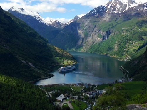
This route continues via ferry to the Geirangerfjord, which I must say is astounding! The advertisements that you see on the TV for the Norwegian Cruises are shot here. I know this as there happened to be a Cruise Ship anchored there!

It’s reputed to be the most scenic fjord of them all, and it really knocks spots off all of the others I’ve seen so far.

The clear green water of the fjord is towered over by the surrounding mountains, almost encapsulating it, and the town of Geiranger within it’s own world. There’s only one road in, which passes through, and then it’s the one road out, snaking up the mountainside to the outside again.

20140527-081021-29421641.jpg

It’s a long hard climb out of Geiranger, many hairpin turns, it’s very steep also. The Landy started to give off the aroma of hot engine, hot oil, and hot clutch, this was partly due to the climb, and partly due to me stopping every few hundred yards to take a photo and then hill starting again!

This climb however, was nothing compared to was was to come.

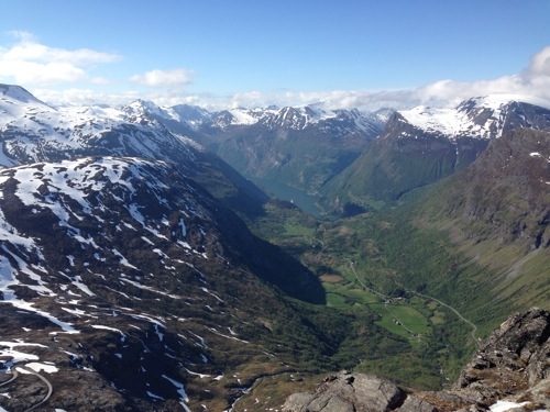
I cleared Geiranger, and continued along the route, I was high in the mountains, and gratefully, snow had made a reappearance. I was thinking that I had seen the last of it in the Arctic Circle but it was here in abundance!

I rounded a corner, and saw a sign for Dalsnibba, ‘The highest view of a fjord from a road’. Sounded good to me so 100kr later for the Toll, I was on my way up, and up, and up! Hairpin after hairpin up to 4900 feet!

20140527-081150-29510331.jpg

This was amazing, partly due to the height and the view, and partly because the Landy made it! (Brake pads were cooking on the way back down though).

The Trollstigen has a reputation as a great road, but I think the road out of Geiranger is far more spectacular.

I was planning to cover two or maybe three of the Najonale Turistveger today, but on leaving Dalsnibba it occurred to me that I had already spent 10 hours on this route alone, it’s 6pm and although still feels like midday in the bright sunshine, I knew I wouldn’t have a opportunity like this again; I stopped for the night, in another of the most extra ordinary of places!

20140527-081302-29582227.jpg

Norway Day 10: A bit of fun!

On this grey and misty morning, I set off to complete the final part of the Atlantic Road, leaving it, and the Article Circle experience behind but stored in long term memory (hopefully!).

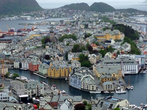
I moved on, back on the tour again, down via Molde and my second fjord ferry crossing to Ålesund, which even in the misty morning light is still a picturesque town situated across several islands, the main part of the town is across two islands; Heissa, and Nørvøya.

20140526-090842-32922466.jpg

This was a brief photo stop as although it was a planned day stop, it was shut! Maybe it was due to being Sunday? Maybe I was too early? (11am). Either way, and although it was going to put me 2 days ahead of schedule again, I decided to continue to another of the main attractions of this journey; Trollstigen!

I didn’t make it though!

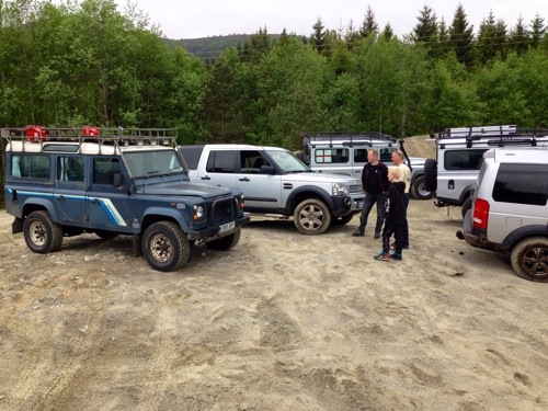
As I passed through a small town Spjelkavik, in a fuel station was sat a Defender, Discovery, Freelander and a Jeep Cherokee, all gave a wave as I drove past.

Now I don’t know about other countries, but in the UK, a group of 4×4’s meeting in a fuel stop on a Sunday morning means only one thing…..Off road fun!

After a turnaround a pass on the road in the opposite direction and yet another turnaround, I eventually caught up with them and followed them when they pulled in to an old sand works.

‘Them’ being the local faction of the Norwegian Land Rover Owners Club!

I had found something to do with my spare day!

I was made to feel very welcome, and I was grateful to meet David, an English Ex patriot who had lived in Norway for 37 years. He has no plans to return to live in England, I think I can understand why.

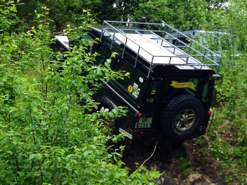
The group of Defenders and Discoveries grew, and I was taken around the area a couple of times. I took a ‘soft’ route around in mine, after all I still have a long way to go and didn’t want to risk any damage.

20140526-091101-33061146.jpg

20140526-091059-33059697.jpg

It was a good day of off road fun!

After a delicious BBQ, I was given a tip on a scenic gravel road to take to Trollstigen. I’m on this road now and really pleasantly surprised at how the day turned out!

Thanks guys!

Norway Day 9: The Atlantic Road.

The Atlantic Road is 8km long, that’s 5 miles in other places and part of one of the 18 Nasjonale Turistveger (National Tourist Route). The full route is around 36km long, which is about 22.5 miles in other places. So why did I clock up about 50 miles and take 6 hours to cover it??

I’m taking a day off from the scheduled tour today, partly because I’m way ahead of schedule but mostly because of how struck I was with mother nature’s handiwork around this area. Even so, I made sure I was awake fairly early, I wanted to get out on the Atlantic Road before there were many cars around.

The Atlantic Road has been named as one of the best driving roads in the world, and it’s easy to see why.

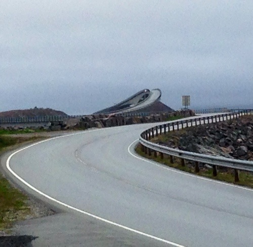
The Atlantic road consists of seven bridges that jump from Island to Island, the most striking and probably the most well known of these is the Storseisundet Bridge, its curved structure seems to defy gravity but makes it a wonder to see and fun to drive!

20140524-183202-66722905.jpg

There are plenty of rest stops along the route all with their own different view of the sea, and all of which I visited!

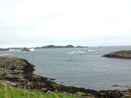
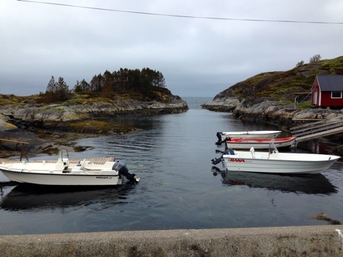
The Atlantic road however is only part of this particular tourist route, and as you continue along the route, you’re taken through small villages and past quaint harbours and what seems like hundreds of various sizes islands, some inhabited, some small, some are just rocks that barely break the surface of the sea, but all today had waves crashing against them.

I have traveled back and forth along this route today, stopped time and again to see the views, I must have reversed the car about half a mile in all after catching a glimpse of something I hadn’t seen before and gone backwards to take a look. In total I’ve traveled the road at least 2 and a half times. It’s only half the third time because I’ve stopped for the night along the route!

Whilst, the Atlantic Road may win the prize for the best architectural attraction on this national tourist route, arguably it’s the more modest and humble views along the way that come out on top.

20140524-183316-66796133.jpg

20140524-183317-66797571.jpg

Norway Day 8: A change of atmosphere

There was a welcome change today; a change of road.

For about 4 days I’ve travelled North on the E6 and then back south again. Hundreds of miles of the same fabulous scenery since entering Norway to the Arctic Circle (of course), and then back down.

After skirting past Trondheim (putting my Auto Toll count now at 21), I changed onto the E39 to head in a more westerly direction towards the Norwegian Sea.

With the change of direction came a change of weather and a change of road type. Now used to the wide open roads and space afforded to me so far in the mountainous region, it was a refreshing change to be on a somewhat challenging at times twisty turny type road.

The odd hairpin bend heading up and down valleys meant either a sudden firm push of the brakes or alternatively a first or second gear crawling climb.

There were more forests and lush green lands around, this could be to do with there suddenly being a lot of hanging mists and clouds in this area. When the road did open out, I was met with large masses of water, contained between steep rock walls.

20140523-193024-70224699.jpg

This is the beginning of my Fjord experience.

I had been past Trondheimsfjorden (where Trondheim is situated funnily), and while it’s large and picturesque, it feels like a lake as you drive around it, not unlike the Lochs in Scotland or Lakes around Cumbria. The difference here now is that the land and Fjords are more intertwined, so there are bridges that are leapfrogging the land more often to get you to your destination. There is also now the use of ferries to cross some areas, it seems that so common is their use, the road signage barely acknowledges that you’re about to board a ferry.

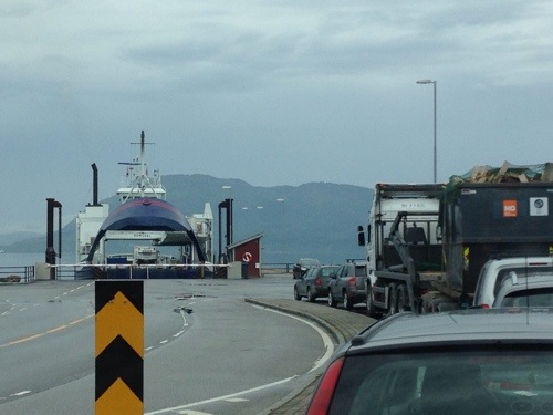
Today was my first Fjord crossing by Ferry, so easy is it, that you simply queue on the road, as if waiting for traffic lights to change. The ferry turns up and disembark the current passengers, you drive in at the crew’s instruction. Then as the ferry moves off, the crew come around for the fare. All very slick except they come to my passenger door. This means I have to reach right across and wind the passenger window down to pay. There must be an easier way as I have the same messing around to do at Manual tolls here also. The biggest pain is driving off without winding the window up and realising there’s no where on the road to for ages to stop and wind it up!

20140523-193401-70441848.jpg

I’ve made it to the ‘Atlantic Highway’ today but I’m going to talk more about that in the next post.

I’m about 2 days ahead of schedule! I wasn’t planning to be here until the 25th, but with the easy roads so far I’ve just kept trundling along.

The Area I’m in is Averøya and I find it quite appealing. So as I’m so far ahead, I’ve decided to take a day off the tour tomorrow and explore a bit.